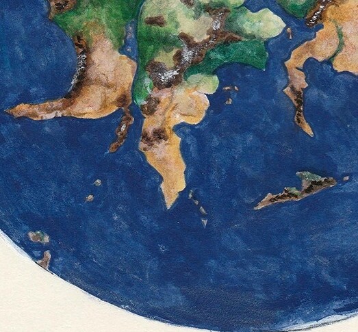
Athas’ current state is more of a mystery, but for the Dead Lands project, based on the little info in the revised edition and very early Drafts of Secrets of the Dead Lands indicating Green Age Ulyan was borderline arctic, we’ve tentatively settled with it being sort of equivalent to the Uruguayan/Argentinean Highlands, getting progressively less green and colder the further south you. The tablelands would thus be more brazil/amazonia, with fairly dense jungles (somewhat matching the Forest Ridge/Crescent Forest) in the middle/northern area and tapering into Cerrado-esque savannah in the areas that would have been Celik, the Endless Sand Dunes, ect.
2 Likes
That’s my view. Take the Tyr region. The further away you get, the smaller the cities, so even if there are other Sorcerer Monarchs out there, they rule over ever smaller cities the further away from the Tyr Region Core. We may as well say that the entire world is populated at some level, but as the TRC becomes remote, there are only nomadic tribes and tiny villages and no cities whatsoever.
This provides a reason for the Sorcerer Monarchs to have congregated in the TRC. If you want the PCs to realize how good they have it in the TRC, have them go in a wild goose chase, looking for the legendary “forest of plenty”. Instead they find nothing but savage tribes, dangerous beasts, and ramshackle villages.
2 Likes
I thought we edited all that stuff out, making the Hoarwall the source of the souther cold, and disengaging it from latitude - leaving it open either way.
We removed the arctic stuff due to it being too much of a stretch, but Ulyan was “cool” due to a mix of natural geography and the Hoarwall, and its also an attempt to match steve bell’s Green Age globe map where the area south of Ulyan gets increasingly more desertified. Mostly for Beyond (Vanarra/Graves of the Fairies being more cool rain forests then temperate or tropical, and the mountains south of Ulyan, stretching into the old Tari homelands, having that glacier in the lands of Elemental Lords and areas of “dirty ice.”
1 Like
2 Likes
Posted here
And as another topic here in this site.
2 Likes
Good stuff. It looks like this is all compatible with our assertion of an equatorial table-lands, and the Dead Lands being southern hemisphere (around Uruguay latitude).
1 Like
I think he’s saying that in order for “high sun/low sun” to make sense from an astronomical perspective, the Tablelands must be significantly away from the equator. (At least 1400 miles). In fact he says in here:
The Tyr Region does not lie at the equator.
So unfortunately an equatorial tablelands is the one assertion that’s not compatible with the astronomy… but I think this is good. It makes poor geopolitical sense as well in a ravaged overheated world to congregate civilization at the equator which would be the least hospitable region… it makes far more in-game sense for the Tyr region to be relatively hospitable.
1 Like
I think this was probably Tim Brown’s intent with mentioning the dead lands formerly being “cold tundra” in Revised Edition and the earliest drafts of Secrets of the Dead Lands. It’s also possible the tablelands were equatorial but all the magical damage done to Athas led to an equivalent of axial tilt and knocked the region into the mid-southern hemisphere. As we’re working off the Steve Bell/Brax map that was the basis for the Athasian Cartographer’s Guild maps, we are somewhat locked into the geography of the greater planet of Athas. One possible explanation is the severe volcanic and tectonic activity that destroyed Remaan (a continent on the other side of the planet that factors heavily in a lot of Brax’s Green Age writing) and effectively wiped out half the planet also severely shifted Athas’ axial tilt and poles.
1 Like
My article is strictly from the perspective low sun high sun idea and does not take into consideration anything in other books about hot or cold regions to the north or south or other geographic or astronomical descriptions that may exist.
But I don’t think the Tyr region is between the two tropics. Tropic of Balamarash and the tropic of Tasker. And is probably over 1400 miles away from the equator. (Assuming at least a 12 degree tilt. But that number is totally arbitrary)
Granted there are a lot of different ideas in all the books and over the years that it’s going to be be impossible to get them all to mash together. At some point you have to just ignore some piece of information. Or just hand wave it. Or just “magic”. I don’t think it’s worth redoing maps or city locations. Most players won’t even realize you gave them: a star map for the northern hemisphere, a description of the sun at the equator at the equinox - when it’s the solstice in the game, and a location in the Southern Hemisphere. This can all be reconciled at a future edition. 5e I’m looking at you. I hope you future writers are paying attention.
A couple of things I want to point out too: lowest elevations are typically the hottest regions on earth. Death Valley for instance. And I would think that a wasteland on the planet that was a plain of black obsidian would also be hot provided it’s not too high in elevation or too far north or south.
3 Likes
Maybe, but logistics. Of they are too far, supplies and manpower would be strained. Then also the forces you deploy take away from.your own in the Tablelands. Thus, making you a target, then there is support of supply lines. Of the region is really far there is setting up pit stops. If there are more regions that are in good shape (which from the old map showing an eastern coast past Ur Draxa) conquering them may be a nightmare.
Also the Tablelands being in the southern hemisphere sounds good to me and since there are no major bodies of water near by to regulate temperature it makes sense why its so hot.