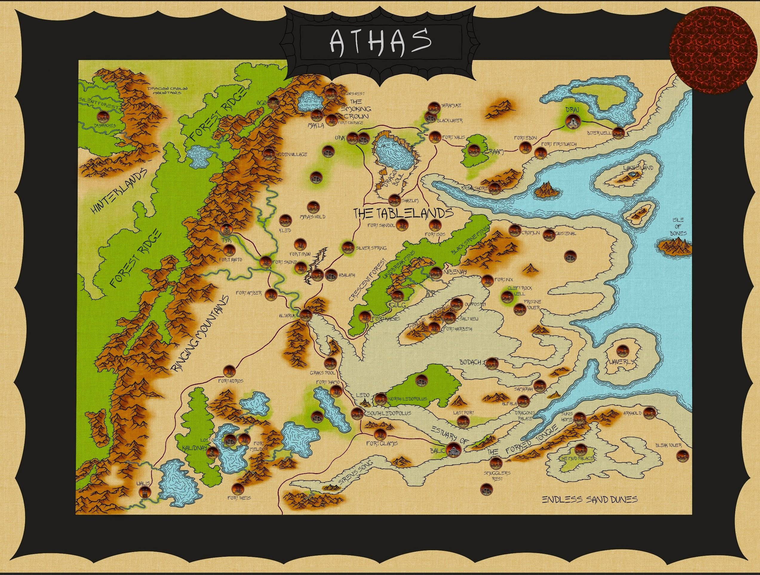
It was made by Dockozel and I found it on Reddit: I like the canvas: it reminds me of the map from the 3e box-set. And I don’t like the city-symbols though; I like my dots!!!
It’s of a greener, friendlier Athas.
It was made by Dockozel and I found it on Reddit: I like the canvas: it reminds me of the map from the 3e box-set. And I don’t like the city-symbols though; I like my dots!!!
It’s of a greener, friendlier Athas.
Says, “This image is broken”
Reddit - Dive into anything This one?
Yes!!!
Imgur is weird.
I do like it. I might use it as an IC woven tapestry that the players can roll up and claim as a treasure.
Resurrection time. Just my 2 cents but this seems to be indicating a state of affairs sometime during the Time of Magic and before the greatest defiling i.e. around the time of the Cleansing Wars took place. There’s way too much water. There’s whole sections of greenery that are gone. Cities that are gone. Land features that are now gone under silt.
It’s a nice artefact and piece of work though. I would do as @Mursey suggested: maybe let PCs find it in game and marvel at the devastation or (more likely) misinformation taking place.
Notably Giustenal still had ocean and forest nearby when it fell, so athas still had somewhat extensive green spots relatively recently post-Cleansing Wars (circa 2,000ish years ago). Iirc the worst of the damage is attributed to Borys during his rampage, where a large majority of any surviving human cities and nations not protected by a Sorcerer Monarch or other powerful entity probably bit the dust.