Hi everyone! I’ve been putting together an interactive map of Athas and got curious about two scale bars from the Athasian Cartographers’ Guild (ACG). On the U-D5 world tile, labeled Expanded Tyr Region, the same line says 100 miles for 2e and 225 for 4e. The Tyr Region map just says 30 miles.
I’d been reading World Size Does Matter topic and looking at the maps Jack Meyer overlaid there. His note about Mollweide was helpful too.
I started by lining up the ACG world map with a Mollweide projection. Its grid didn’t quite match, so I used control points to fit it. From there I used the continent outlines and the sheet grid to place the regional overview maps, then matched the detailed maps to the sheets they overlap. That put everything on a shared latitude and longitude grid for an Earth-sized Athas.
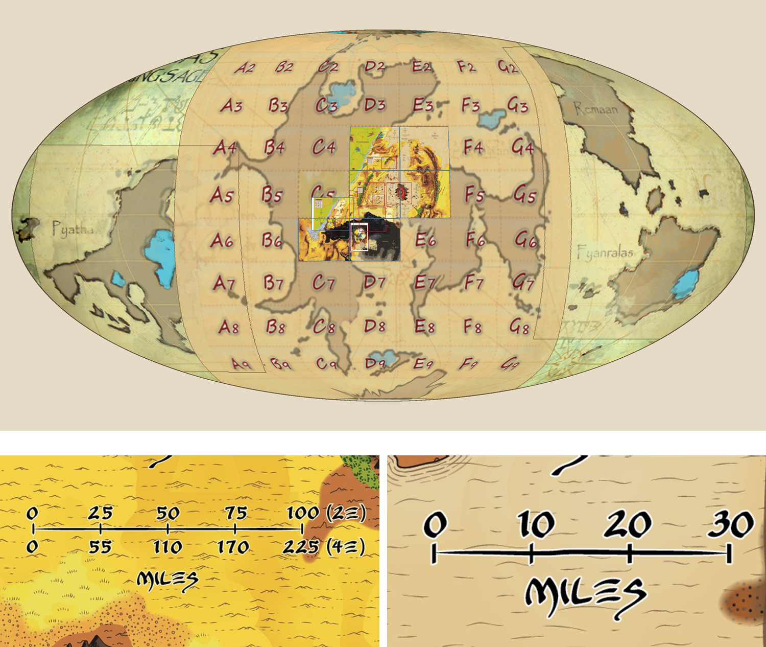
For the scale bars I went back to the original images and measured in pixels. Urik and Balic are about 1,109 pixels apart on U-D5 and 2,269 on Tyr Region. If I shrink Tyr Region until those cities are the same distance apart on both maps, its 30-mile ruler goes from 380 pixels to about 186. That gives me about 6.19 pixels per printed mile on Tyr Region at that size and 5.24 on U-D5’s 2e ruler. If the rulers use the same kind of mile, that’s about an 18% difference relative to U-D5.
The overview below shows where the sheets fit. There are also scale bars from U-D5 (left) and Tyr Region (right). Map artwork adapted from the Athasian Cartographers’ Guild’s World Maps catalog, CC BY-NC-SA 4.0.
I got similar numbers for Grey Coast, Trembling Plains and Lost Cities by matching their overlapping artwork. Grey Coast was matched through Tyr Region, and Lost Cities through Trembling Plains.
Does anyone remember whether the Tyr Region ruler was meant to use the same miles as the 2e row on U-D5? I’d be curious to know whether the two sheets used the same ruler template.