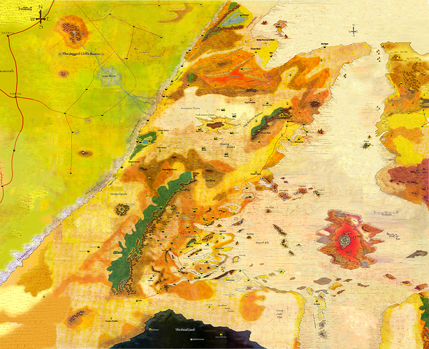
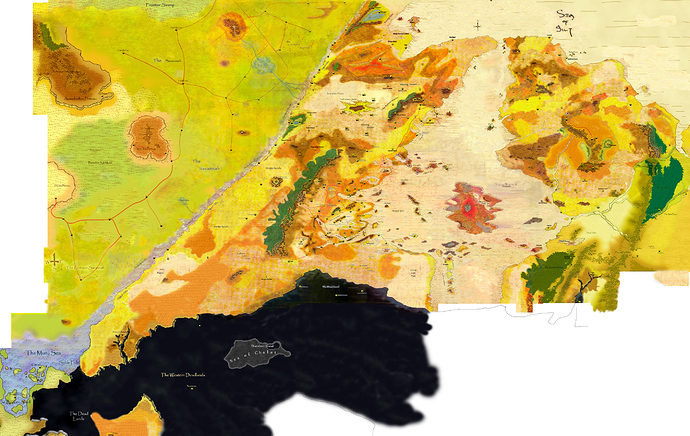
How did you do it? Which software did you use?
What about these Maps?
Is there a higher resolution, or only 1526 x 1242?
Looks great otherwise!
Pretty awesome!
Great job!

Yep, got all of those already.

With Photoshop and a lot of patience 
This is great work. I wonder if I can load this onto a memory stick and take it into my local staples to print it on something huge. Anyway great job OP
Still an absolutely beautiful map, and certainly the best of its kind.
One question: Is this different from the larger one you posted in another feed?
http://arena.athas.org/t/world-maps-for-athas/497/46?u=neujack
Ifs the east part of the map official?
Past the Valley of Dust and Fire? No.
The Athasian Cartographer’s Guild effectively designed this entire continent and laid out the rest of the planet roughly, based on the maps from many previous players. What you’re seeing here is a portion of their full map, beautifully improved by Jhonny. The part beyond the Silt Sea is the the Sundered Regions (from another member’s posts).
We’ve been discussing this map in another feed as well:
Hi @Kalakoftyr
This is the last version of the Athas continent map. I’m working on it  With better resolution.
Of course you can use it. Enjoy!
Hey @neujack ! The smaller one was an earlier version from the another feed.
The one attaching here is the last version.
Keep in touch!
BTW the Dead Lands part is a work in progress.

